| Moorcourt to Romsey |
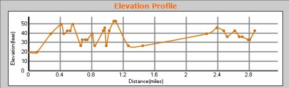
Distance 2.9 miles, a straight walk, which starts at Moorcourt Farm (see previous walk for parking details), and ends just off the Test Way, in Romsey. There is good parking (2 hours only from 8am to 2pm, then completely free), in The Meads, besides Romsey Memorial Park. Near the end of this walk, the path reaches the busy A3090. Turn right, cross the road by the pub, and then turn left just before Middle Bridge. At the end of The Causeway, cross the river by the famous Saddlers Mill to get to The Meads. A really pretty walk, which we did in glorious sunshine one Thursday morning. It poured about 15 mnutes after we finished the walk! Park on the red circle below, and either load the GPX file into your GPS, or follow the TW signs. You can scroll the map below simply by moving the mouse with the left-button held down.
|
|
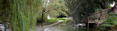
© Copyright Jim Champion and licensed for reuse under this Creative Commons Licence
See other pictures of this area here.
To download GPX Files, right-click the link, choose Save Link As ..., and save it to wherever you keep route files.
See the documentation that came with your GPS for information on how to download the route to your GPS.
These are a selection of Ordnance Survey Maps that cover this walk.
Geocaches on route
No Geocaches on this section.
Not even any caches nearby!